 |
| Scawthorpe in the 1950's |
From Castle To Conurbation
Looking at Scawthorpe today, with it's rows of local authority housing, you would think it has very little history of interest, and I must admit that before I embarked on this project I thought an article about Scawthorpe would be very short indeed. Well how wrong I was. The land which is now home to a twentieth century housing estate has a much older tale to tell, with a history stretching back to Roman times, a history which includes a Roman road, a medieval castle, a moat, a hall and a large farm.
And so we begin our look at how the Scawthorpe we know now has developed over the centuries.
Contents
- Land By A Roman Road
- Skuli-thorp
- Castle Hills And Radcliffe Moat
- Agriculture And Quarrying
- Scawthorpe Farm And Hall
- New Development
- First Phase Of Housing
- Scawthorpe County Primary School
- Shops And Amenities
- Don Valley High School
- Gunter Helft
- Don Valley Academy
- Demolition And Rebuild
- Churches
- Scawthorpe Photos
- General Photos
- Castle Hills School
- Don Valley High School
- York Road
Land By A Roman Road
 |
| Roman Ridge, in red. |
Modern Scawthorpe lies in a triangular area of land bordered by Bentley to the east, the Great North Road to the west, and open fields to the north before reaching Adwick le Street.
To the west of the Great North Road lies the Roman Ridge (or Rigg). A now unused part of the old Ermine Street, which was a Roman military route between the forts at Doncaster and Tadcaster.
Beginning at the junction of Barnsley Road (A635) and the Great North Road (A638) and ending at the Redhouse Interchange, north west of Adwick le Street, this three mile stretch of exposed Roman road is all that is left of one of the most important routes of colonial Britain.
The modern A635 (Barnsley Road) overlays what used to be a medieval 'saltway' or 'saltergate' which was used to bring salt to Doncaster via the Pennines from the production sites in Cheshire.
These two ancient roads converge at the Great North Road/Barnsley Road junction, which was originally named 'Bodles' and is now home to the Sun Inn.
 |
| The Sun Inn 1915 |
Skuli-thorp
The first documented use of the place-name 'Scoulthorpe' appears in a document of 1317. It is believed to derive from an Old Norse personal name 'Skuli', coupled with the Scandinavian 'thorp', meaning 'secondary settlement, dependent farmstead or hamlet'* and was probably a satellite settlement of Arksey or Bentley. When Roman imperial rule ended the roads mostly fell into disuse but their banks, called 'aggers' made convenient land boundaries for Scandinavian and Saxon landowners. The Roman Ridge formed the boundary for the parish of Arksey with the early post-Roman settlement remaining near the centre of the estate.
 |
| The Roman Ridge from Green Lane |
Scawthorpe does not appear in the Domesday Book of 1086, but it probably formed part of the Bentley estate under the ownership of Roger de Bully.
Castle Hills And Radcliffe Moat
Nigel Fossard was a major tenant of Robert, Count of Mortain (the half brother of William the Conqueror). Fossard was an important supporter of King William, and following the Conquest in 1066 he was rewarded with land for his loyalty and service during the battle with King Harold. He held extensive properties from the count all over Yorkshire and that included the manor of Arksey which encompassed Bentley, Scawthorpe, and other satellite settlements in the area.
 |
| Nigel Fossard |
Fossard left his mark on the area by building fortified manor houses, two of which were situated by the deserted village of Langthwaite (later Hangthwaite), which is just north of present day Scawthorpe.
The de Langthwaites who owned the manor of Langthwaite in the twelfth century became quite an important family, with their name appearing in many northern documents.
In the Tudor period the manor was owned by the Woodruffes of Woolley, and was sold by Francis Woodruffe in the reign of Elizabeth I.
 |
| Castle Hills and Radcliffe Moat 1849 |
The two earthworks of Castle Hills and Radcliffe Moat are all that physically remains of the manor of Langthwaite.
Castle Hills is an 11th century scheduled ancient monument, which consists of a 4-5m high motte with a kidney shaped inner bailey to the north, and a sub-rectangular outer bailey to the east, the outer bailey measuring approximately 70m x 40m. Its complex earthworks suggest this was an important monument which would have dominated the approach to the village along what is now Langthwaite Lane.
In the later middle ages (14th or 15th centuries) Castle Hills was superseded by Radcliffe Moat, which lies some 500m to the east north east, and now lies partly under railway embankments. This trapezoidal island measures 65m on the east side, around 55m on the north side, under the railway embankment, 50m on the south side, and around 45m on the west side. Joseph Hunter (Hunter's South Yorkshire 1828/31) makes reference to a house demolished there in the late 17th century, which had belonged to Sir William Adams, but there is no obvious building platform within the site today.
 |
| Aerial view of Castle Hills and Radcliffe Moat today |
Between the two monuments of Castle Hills and Radcliffe are the remains of the lost medieval village of Langthwaite (or Hangthwaite), now just a collection of earthworks.
Agriculture And Quarrying
While the Langthwaite area has evidence of early occupation, the same cannot be said for the lands further to the south. These lands seem to have been used primarily for agricultural use. Evidence of medieval ridge-and-furrow strip farming are recorded on the surveyors' draft plans for the 1830 Enclosure scheme. These furlongs lay to the north and west of Pipering Lane, which used to be a continuous route between Bentley and York Road (part of the Great North Road).
 |
| Field patterns in the Scawthorpe area, 1849 |
Apart from agriculture there is evidence of early industry in the area with the remains of Long Edge Quarry lying to the west of Long Edge Lane. Magnesian limestone has long been quarried in the Doncaster area, mostly for building purposes, and although the age of Long Edge Quarry evades me it features on many maps from the mid 1800's up to the mid twentieth century.
 |
| Long Edge Quarry 1849 |
Scawthorpe Farm And Hall
By the mid nineteenth century Scawthorpe consisted of no more than one single farm situated on the west side of the Great North Road. This main thoroughfare between Doncaster and Boroughbridge had been a turnpike road since the mid eighteenth century. In 1741 a Turnpike Trust was established to collect tolls from travellers using its particular section of road; the reason being to maintain the road with the profits. The turnpike gates at York Bar remained standing until 1880.
 |
| Barnsley Road Toll House |
According to the 1871 census a family by the name of Morton were living at Scawthorpe Farm, which consisted of 200 acres.
 |
| Scawthorpe Farm on a map of 1849 |
By 1881 the single farm had grown in size, to now include Scawthorpe Hall and by the end of the century it was joined by three lodges, North Lodge, Middle Lodge and South Lodge. South Lodge was positioned by the entrance driveway to the Hall.
 |
| South Lodge |
 |
| Scawthorpe Hall, Lodges and Scawthorpe Grange 1907 |
Living at the Hall in 1881 was Edward Jackson, farmer. His son Edward Walker Jackson, a retired cloth manufacturer who designed the Cheswold motor car, lived at nearby Scawthorpe House.
 |
| Cheswold car, 1914 |
The Hall in the early 1900's had tennis courts, stables, a laundry and a sunken rose garden.
 |
| Scawthorpe Hall |
During World War 1 soldiers were billeted at Scawthorpe Hall, the photo below shows 'D' Company, 14th Platoon, 51st Sherwood Foresters, Scawthorpe Hall, February 1918.
 |
| WW1 Soldiers billeted at Scawthorpe Hall, 1918 |
After the First World War miners from Brodsworth bought plots of land on Green Lane for development. A temporary 'tin city' made of corrugated shacks, wooden huts and railway carriages sprang up to house the miners and their families while they built permanent houses. The area became known as 'Little Canada' as the structures resembled Canadian houses. The 'houses' did however, have to be inspected and approved 'habitable'.
In 1904 the Barber Walker Company, who also owned Bentley Colliery purchased the entire Scawthorpe estate, including the Hall. The colliery agent Mr McGregor lived in the Hall, while the chauffeur lived in the South Lodge and the farm manager lived in Middle Lodge. The Hall was continually occupied by colliery agents until around 1960.
By the 1980's the Hall and other buildings had been demolished and the site was redeveloped for housing under the name 'The Sycamores'.
New Development
First Phase Of Housing
The 1930's saw the first phases of residential development in the Scawthorpe area. Sunnyfields was laid out on land once belonging to Scawthorpe Farm, to the west of York Road, and is characterized by its flat roofed houses which originally cost around £380 new.
The Sun Inn was rebuilt in 1936; it was built nearer to the junction with Barnsley Road and the old inn was demolished shortly after.
 |
| The new Sun Inn under construction, with the old building behind. |
Private houses were built in the Raymond Road area, as can be seen on this 1938 map (below). Raymond Road at the time was built as a cul-de-sac.
 |
| Sunnyfields and streets south of Scawthorpe 1938 |
 |
| Sunnyfields 1935 |
At the same time as Sunnyfields and the Watch House Lane area were being developed, work had also commenced further north.
Middlegate was the main thoroughfare between Bentley and York Road, it ran from the end of Brustlingholme Lane at the railway bridge, to York Road in the west. The first phase of building began north of Middlegate with the creation of Scawthorpe Avenue, Walden Avenue and Ashton Avenue in 1935.
 |
| Streets appearing in north Scawthorpe, 1938 |
Post-war building initially consisted of semi-permanent and permanent housing.
In the mid 1940's council housing was built on Long Edge Lane, Langthwaite Road and Balham Avenue.
Around 1950 Middlegate and Brustlingholme Lane underwent a change of name. The two roads became one and the name was changed to Jossey Lane. It was named after a local character 'Bentley Josse' who lived in a ramshackle hut on the lane and worked as a 'knocker upper' in Doncaster.
 |
| 'Bentley Josse' |
For more on Bentley Josse go to Bentley Street Names.
The name 'Middlegate' was reused for a new street between Ballam Avenue and Castle Hills Road. Pre-fabs were built on the new Middlegate and Jossey Lane.
 |
Coronation party on Middlegate 1953 (note the pre-fabs).
Photo courtesy of Bill Wright |
Scawthorpe County Primary School
At first there were no shops, schools or other amenities in Scawthorpe, the nearest being in Bentley. Scawthorpe County Primary School opened in May 1952 with 250 children registered. In 1955 the school separated into two departments, infants and juniors when a new infant's school was built next door. The school was amalgamated in 1992, becoming Castle Hills First and Middle School, before finally becoming Castle Hills Primary School in 1993.
 |
| Scawthorpe Primary School 1962 |
 |
Scawthorpe County Primary School staff 1955.
Photo courtesy of Bill Wright |
See below for more Castle Hills School photos.
Second Phase Of Housing
The second phase of house building got underway in the early 1950's. Amersall Road, as the 'spine' road was built first in 1951 and was soon joined by Springcroft Drive, Stonehill Rise, Amersall Crescent, Broachgate and Homefield Crescent. By 1955 the National Coal Board had built over 300 homes on Jossey Lane, Danesway, Petersgate, Newstead Road, Clevedon Crescent, Woodside Road and Chatsworth Crescent. Concrete housing was built mainly to accommodate an influx of Scottish miners.
 |
| Amersall Road and the Adam & Eve public house |
Private housing on Amersall Road was also developed in the 1950's. Beginning at the junction with Stonehill Rise and ending at the former cul-de-sac of Raymond Road. Amersall Road was joined up with Raymond road thus creating one road with two names. Land was also available for £275 per plot and many people built their own houses. Building continued into the 1960's. North of Stonehill Rise, Amersall Road consisted of council housing.
 |
| Map of Scawthorpe 1958 |
Pipering Lane, once a continuous track from Bentley Railway crossing to York Road was intersected by Amersall Road and Stonehill Rise, resulting in the two roads, Pipering Lane East and Pipering Lane West, which do not meet.
Shops And Amenities
The Co-op was the first to open a shop in Scawthorpe, this was on Stonehill Rise and was followed by Meadow Dairy situated next door. Herring's General Store on Scawthorpe Avenue accommodated a post office some time after it opened. The newsagent Mr Dunn sold his newspapers from a wooden hut until he moved into premises on Crossland Way.
 |
Don Valley High School in the 1960's.
Photo courtesy of Colin Hardisty |
The name Don Valley Comprehensive School didn't last long. Reportedly at the insistence of Headmaster Mr Horncastle, it reverted to its previous name Don Valley High School.
 |
| School emblem |
In the early 1970's the age for starting secondary education was altered slightly to the age of 12. This resulted in the rather confusing first year students being called 'second years'. The name 'first years' was dropped and students completed their 'second' and 'third' years in the lower school, up to the age of 14, then completed their 'fourth' and 'fifth' years in the upper school, up to the age of 16. Those wishing to leave education at the age of 16 left after the fifth year exams (C.S.E's and O Levels) were completed. Those wishing to stay on until the age of 18 attended the 'lower sixth' and 'upper sixth' forms, completing their A Level exams at the end of their school lives.
 |
Teachers in 1982.
Photo courtesy of Martyn Didcott |
Gunter Helft
The Headmaster during my time at Don Valley High School (mid 1970's) was Mr Gunter Helft, a native of Berlin, born in 1923. He witnessed the brutality of Nazi Germany at first hand before fleeing to London with his parents in 1933. Despite his Jewish upbringing, an interest in Christianity led to him being ordained in 1948.
Working as a chaplain in an Essex School forged an interest in education and he moved to Birmingham, where he married and had two sons. After a move to Japan, and then Port Sudan, the Helft family moved back to the UK, where Gunter continued to work within the church and education. His first job as Headmaster of a large comprehensive was at a school in Lambeth, after which he became Head of Don Valley.
In about 1983 he was treated for throat cancer and lost his voice completely for a time. He moved to Worcester and was persuaded to take up the priesthood again. In 2001 he wrote the book From The Head Upwards, an examination of comprehensive schools. He suffered a stroke in 2008 but fought on, writing an autobiography Not Lost For Words, in 2012. He finally passed away in 2015 at the age of 92.
For more on the life of Gunter Helft go to Church Times - Obituary.
 |
Black and white image of Gunter Helft from his time at Don Valley.
Photo courtesy of Chris Brocklehurst |
Don Valley Academy
In 2006 the school became a Performing Arts College as part of the Specialist Programme introduced in schools in 1997. Specialist schools allowed secondary schools to specialize in certain fields of education, such as Media, Sports, and Technology. The Specialist Programme was phased out as Academy schools were introduced in the year 2000.
In 2011 Don Valley became part of the Delta Academies Trust and is now known as Don Valley Academy.
Demolition And Rebuild
By 2015 some of the older school buildings had been in use for almost 60 years, and the remainder around 50 years. Now showing their age and no doubt costly to maintain, it was decided to build a new school and demolish the whole of the old one.
 |
| Impression of how the new building would look. |
A smart, modern new building was built on the existing site, alongside the old school, so students could carry on learning while the new school was completed.
The new building was sited over the old tennis courts, parallel with Jossey Lane and is three storeys high. At just over 1000 students, it is smaller than the old school and more compact.
The new school opened in November 2016 and work then began to demolish the old buildings.
 |
| Google Earth image showing the new school at the top and the partly demolished old school lower down in 2017. |
See below for more Don Valley High School photos.
Churches
Before any churches were built in Scawthorpe the building which was to become Castle Hills Middle School was used for church services. The Church of England used it in the mornings and the Methodists in the afternoons and both had Sunday Schools.
In 1958 the Methodists got their own church, a red brick building on Amersall Road, opposite the Adam and Eve. It was built with help from the Joseph Rank Benevolent Trust.
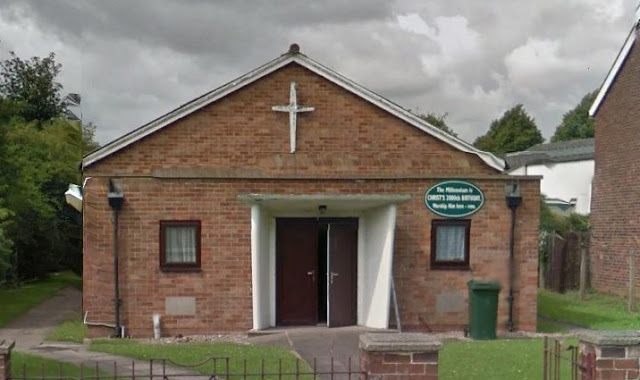 |
| Scawthorpe Methodist Church |
The white washed church of St Luke's was built on Broachgate in 1965 for the Church of England. A nearby white hut provided space for Sunday School, Cubs, Brownies and Guides, the Guides' leader being a Mrs Lawton.
 |
| St Luke's Church |
Modern Scawthorpe
 |
| Google Earth view of Scawthorpe |
With Scawthorpe firmly established as a residential area in its own right, other amenities were added such as a new library in 1962, an off-licence, launderette, Tree's the bakers, Clark's the barbers, Robinson's the dentist and a garage, which later became a Lada dealership, on Amersall Road.
By the early 1970's levels of development were roughly at the same as they are today. Land to the north of Danesway and east of Amersall Road, at the Watch House Lane end has since been developed, but apart from that Scawthorpe has largely remained the same.
Suburban Scawthorpe might be seen as nothing more than a mid twentieth century housing estate, but in reality it has a rich history stretching right back to one of the country's most important Roman Roads and for that reason alone, it places it firmly in the fascinating historical landscape of north Doncaster.
Scawthorpe Photos
General Photos
 |
| Scawthorpe Farm |
 |
| Probably Scawthorpe Farm |
 |
| Scawthorpe Farm |
 |
Amersall Road flooding.
Photo courtesy of Suzy Deeley |
 |
Ballam Avenue Coronation party 1953.
Photo courtesy of Bill Wright |
 |
Coronation party 1953.
Photo courtesy of Bill Wright |
 |
Darby and Joan club 1950's, Scawthorpe Junior School.
Photo courtesy of Bill Wright |
 |
Scawthorpe Methodist Church fancy dress competition, 1950's.
Photo courtesy of Bill Wright |
 |
| The Flying Scotsman at a flooded Castle Hills junction in 1932 |
Castle Hills School
 |
Castle Hills School c1966.
Photo courtesy of Susanna Merryweather |
 |
Castle Hills School c1966.
Photo courtesy of Susanna Merryweather |
 |
| Castle Hills School c1970 |
 |
| Castle Hills School c1970 |
 |
Castle Hills Infants 1970.
Photo courtesy of Wayne Goddard |
 |
Castle Hills Infants 1970.
Photo courtesy of Wayne Goddard |
 |
Castle Hills School 1975.
Photo courtesy of Wayne Goddard |
Don Valley High School
 |
Don Valley High School 1974-75
Back row L to R, Steve Nellis, Stephen Lister, Vinny Clifford, Andy Heath, Nicholas Kornjaca, Barry Smith, Kenny Hall, Martin Ashton, Graham Taylor.
Front row L to R, Don Smith, Steve Foulks, Steve Foster, Paul Atkinson, Mark Williamson, Kevin Barsby.
Photo courtesy of Kevin Barsby |
 |
Teacher's football team - 'Wainwright's Wondermen' March 1981.
Back row L to R, Geoff Deakin, Paul Eley, Roy Winstanley, Ken Brandreth, Stewart Walker, Dave Redfern.
Front row L to R, Clive Stirland, Rob Critchley, Phil Burch, Gordon Wainwright, Doug Maund, Mike Turner.
Photo courtesy of Les Plimbley |
 |
Teacher's football team - 'Jackson's Giants', March 1981.
Back row L to R, Graham Stanbury, Pete Hemingway, Mike Waddington, Frank Richardson, Dave Smith, Mike Gallifant, Jim Mortimer.
Front row L to R, Pete Reeves, Les Plimbley, Ian Jenkinson, Alan Maltby, Cyril Jackson, Lee Shoesmith.
Photo courtesy of Les Plimbley |
 |
Graham Topliss (seated) and class from May 1977.
Photo courtesy of Julie Booth |
 |
Reconstruction of a Roman pottery kiln by 4th year students in 1977
(see also newspaper cutting below)
Photo Courtesy of Brian England |
 |
Newspaper cutting about the Roman pottery kiln,
see below for a transcription of the text. |
'Art teacher Graham Topliss (below), with some of the fourth year pupils of Don Valley High School, firing the reconstructed Roman pottery kiln. They are Shaun Box (14), Tony Robinson (14), Maureen Bradford (15), Brian England (14), Elaine Barry (15), Agnes Higgins (15), Sharon Hudson (15) and Ronald Vainlo (15).' Yes that is my husband!
 |
| Myself in 1974 wearing a candy striped school blouse |
Photos of Don Valley High School taken between 1975 and 1979. Courtesy of Paul Slater.
 |
| Looking towards the science block, lower school. |
 |
Lower school music block (left), looking towards
Stonehill Rise entrance. |
 |
| Lower school playground looking towards the gym. |
 |
| Lower school buildings looking south |
 |
| Don Valley High School taken from the foot bridge on York Road. |
 |
| Jossey Lane entrance and upper school buildings. |
Sources
* Smith, A. H., 1961, The Place-names of the West Riding of Yorkshire, Part 1, Lower and Upper Strafforth and Staincross Wapentakes: The English Place-name Society, Vol XXXXVII. Cambridge University Press.
Sources: Memories of Scawthorpe - A Local History Guide produced by Doncaster Libraries (courtesy of Colin Hardisty, with extra information given by Bill Wright).
Scawthorpe - By Symeon Mark Waller, originally available on his Doncaster History website.
Archaeological report for Gray & Adams by Pre-Construct Archaeology (Lincoln)
Many thanks to Bill Wright for photographs and information.
Alison Vainlo
First written 2016, updated 2020


